De Vuurberg
© A. van Roekel
Home Milieu & Energie Gezondheid & Wetenschap Duurzaam Bouwen Photo Gallery
Geologie & Reizen Landbouw & Voeding Natuurbescherming Eilanden Geo-educatie


LANZAROTE AND ITS ISLETS:
La Graciosa, Montaña Clara & Alegranza


LANZAROTE: THE VOLCANIC CORE TIMANFAYA


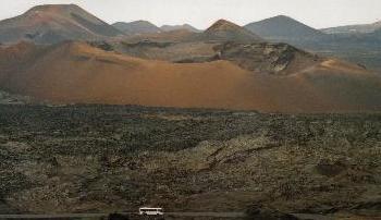
  Fire Mountain © Annemieke van Roekel  

Photo: The golden mountain in the core of Parque Nacional de Timanfaya in Lanzarote. Lanzarote and Fuerteventura belong to the same volcanic complex and are the eldest islands of the Canary Archipelago, dating back to between 15 and 20 million years ago. The Canary Islands are shaped by a hot spot in the mantle of the Earth.


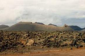
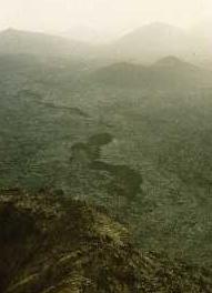
  Eroded volcano © Annemieke van Roekel Lava flow © Annemieke van Roekel  

Left Photo: An eroded volcano at the border of the Montañas de Fuego.
Right Photo: Lava flows dating back to Lanzarote's youngest eruptions that took place in the 18th and 19th century. Active volcanoes in the western part of the island covered a big part of the island with lava and enlarged the island. The subsoil in this area is still hot.

Next page: Agriculture on volcanic soil - part I

New on this site: Geo-artist César Manrique.
Manrique: "Are you aware, Lanzarote, of what your death might mean? If you die, it will be for good. Never will you be able to recover life".

© Annemieke van Roekel. Niets van deze website mag worden vermenigvuldigd of openbaar gemaakt door middel van druk, microfilm, fotokopie, plaatsing van teksten en/of afbeeldingen op andere websites of op welke wijze dan ook zonder voorafgaande schriftelijke toestemming van de auteur en de betreffende tijdschriftredacties.
Laatste wijziging: 27 september 2013
[home] [top] [contact] [disclaimer]