|
||||||||||||
|
Part I (this page) 
|
Gavdos Island, a Lifted and Tilted Aegean Crustal Block
Text, photography: Annemieke van Roekel, geoscience journalist Gavdos is a small and relatively unknown island southwest of Crete. On clear days.
the high mountains on either side of the famous Samaria gorge in Crete can be clearly seen. The island is especially popular
with travellers who want to camp freely under and between juniper trees and tamarisks on the northern beaches. In the last
decades, a handful of apartments were built, so those who do not want to camp under the open, starry sky can also find a
suitable home. The tourist pressure is limited to the summer months; from October to May there is little to do and there is
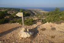
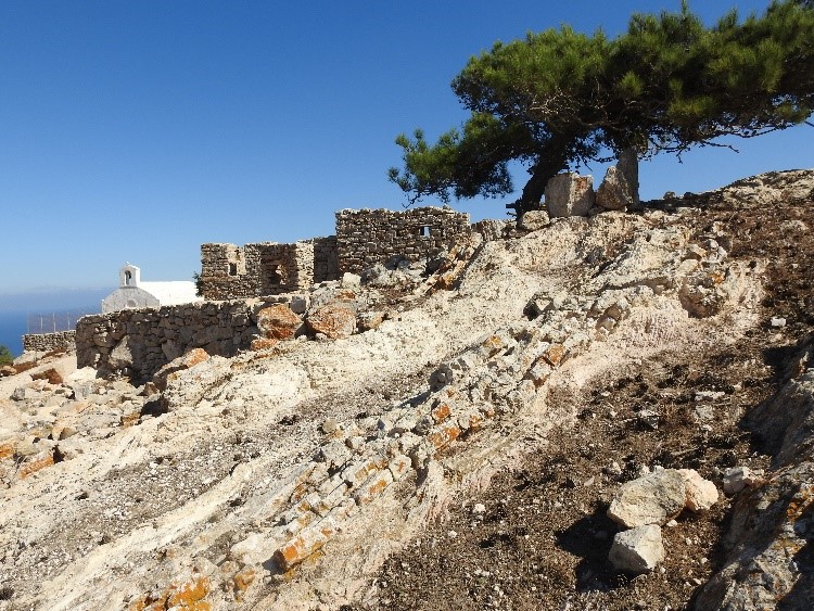
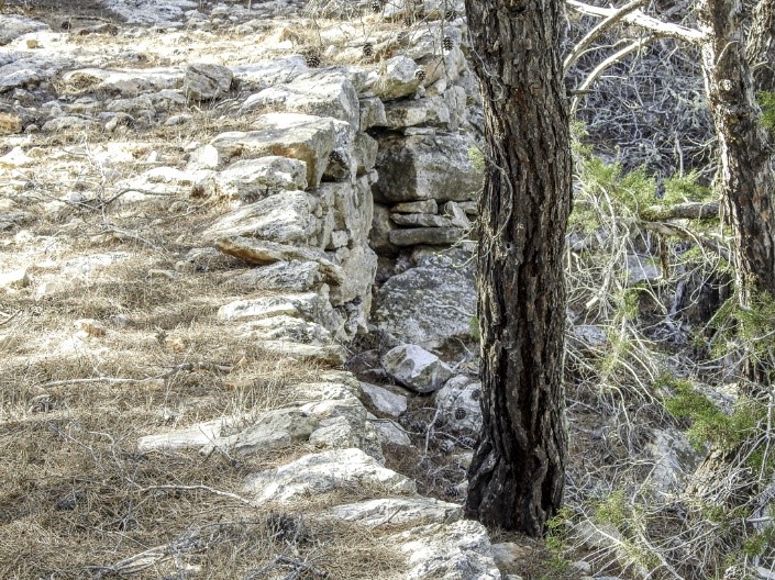
an overwhelming calm. Around forty people live on the island all year round. With an area of approximately 30 sq. kilometres, the almost audible silence, the Mediterranean visible from almost every location, trees in the most capricious forms and the possibility of walking virtually everywhere, it is an attractive travel destination (photo above, left). Hiking trails have been well marked; some of them must be very old, such as the path between the centrally located village of Kastri and Ampelos, in the west. This is a breathtaking path through pine woods, with an ancient pavement made of local limestone (photo above, right). "This pavement might go back to the Venetian period," says Katerina Kopaka, archaeology professor at the University of Crete in Heraklion. Since the early 1990s, Kopaka travelled to Gavdos almost every summer to supervise archaeology students. "After years of systematic mapping of the archaeology of the entire island, we are now digging north-east of Kastri on a site that once housed a large agricultural housing complex, which dates from before the middle of the second millennium BC." Archaeologists have proof that Gavdos was already inhabited in the Middle Neolithic Period (5000 BC). The history of this island goes even further back, to the Palaeolithic. Kopaka's work has shown that on this southernmost tip of the European continent, many generations and thousands of people must have once lived. Ancient terrace walls all over the island, overgrown and covered with lichen, suggest that there must have been an intensive agricultural culture here. Shelter behind the steep south coast On historical maps we come across Gavdos in various forms, under the name of Claudia. Gavdos is mentioned in the Bible (Acts 27). The apostle Paul anchored with his ship to escape the infamous winter storm Eurakylon, when, on his trip to Rome, he was unable to the old port of Phoenix on southwest Crete. Fik Meijer, emeritus professor of Ancient History at the University of Amsterdam, describes the journeys of Paul (Meijer, 2012): "Despite the storm, the skipper had managed to temporarily seek shelter from a high coast. In the manuscripts this islet is called C(l)auda or and K(l)auda. Its south coast rises more than 300 meters high and its slopes head northwards. A suitable place to find some shelter against the harsh north wind." Horsts and graben Both Crete and Gavdos consist of a collection of horsts and graben, which are geological structures which indicate tensional forces and crustal stretching. The seabed separating both islands, which has a depth of more than 1 km, also consists of such blocks. Strike-slip and reverse faults, a result of compression, have taken place here even during the Pleistocene. The area is still seismically active as a result of continued subduction. The tilting of the "Gavdos block", which led to the characteristic shape of the island, must have taken place around 11 million years ago, according to Jan Willem Zachariasse, geologist at the Geoscience Department of Utrecht University in the Netherlands (see the box text 'Gavdos in geological perspective' for a detailed description of this process.). Through this tilt, the older Pindos rock, which form the base of Gavdos, is seen on the entire south side. Last update: 18 November 2021 |
|||||||||||