|
Home
Page 1/6
Page 2/6
Page 3/6
Page 4/6
Page 5/6 (this page)
Page 6/6
|
El Hierro, the youngest Canary.
Island of landslides
webpage 5/6
Text: Annemieke van Roekel, geoscience journalist
www.vuurberg.nl.
This article was first published in Gea Magazine (September 2022).
Ferro Meridian
The geographical history of the westernmost part of El Hierro shouldn't go unmentioned here!
Indeed, in ancient times, the Canary Archipelago was considered the end of the
known world. A few kilometers from the beach of El Verodal is
Punta de la Orchilla, near the volcano of the same name, with the lighthouse nearby.
A plaque recalls that El Hierro was considered the end (or beginning) of the inhabited
world by the Greek geographer/ mathematician/ astronomer Ptolemy in the 2nd century
AD (Fig. 13).
After Greco-Roman times, the 'Ferro Meridian' was still considered the reference
for centuries. Until the Dutch Golden Age, this 'prime meridian' was noted as "Ferro"
on seafarers' charts. In 1795, the British hijacked this position with the "zero meridian of Greenwich"
(London), 18 degrees east of the Ferro Meridian.
In the late 19th century, it was decided internationally
to use Greenwich as the prime reference meridian, but in some countries, such as Germany and Austria,
the Ferro meridian is still used as an additional reference meridian.
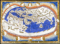
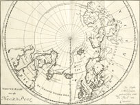
Fig. 13. 15th century map based on the geography of the world in the 2nd century
AD by Ptolemy. Fig. 14. Some cartographers deviated from his, as is illustrated by this Dutch fishing
map from 1720: the reference meridian is drawn over "the Peak of the Canary", referring to the
Teide (Tenerife).
Maps are both public domain.
Geopark
El Hierro has been a Geopark since 2014, and quite a few information centers have been set
up as a result, such as the Centro de Interpretación del Geoparque and the Centro
de Interpretación de la Reserva de la Biosfera. But surely the best-equipped museum
is the Geological Museum in El Pinar, where island evolution is explained through
large photographs, diagrams and all sorts of volcanic rocks (Fig. 15).
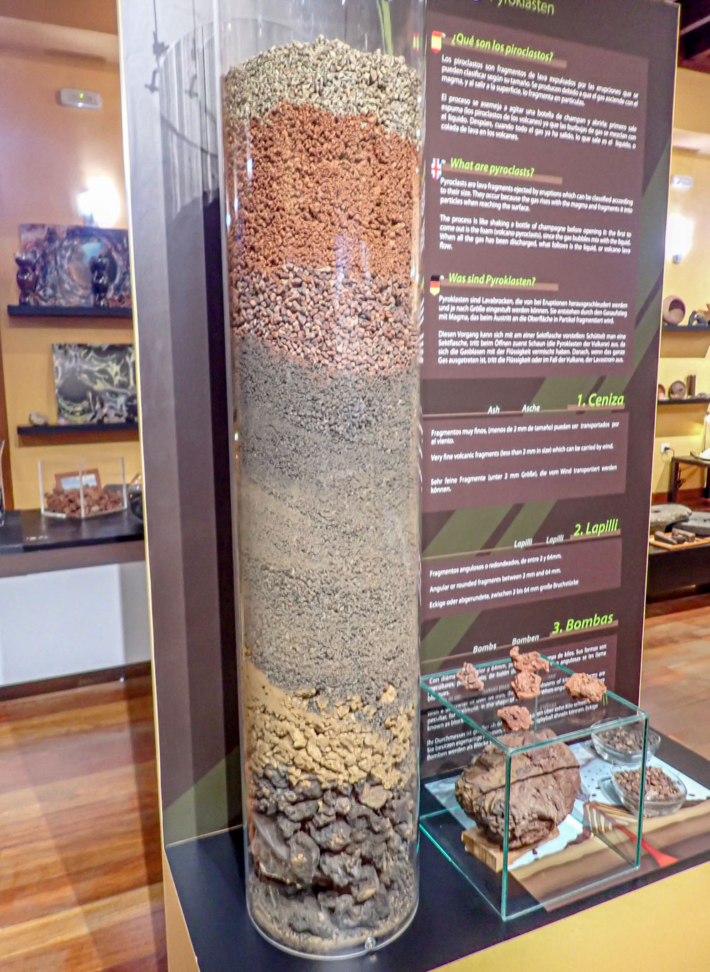
Fig. 15. Pyroclastic material, from coarse to fine. Arrangement at
the Geological Museum in El Pinar. Lapilli include angular or round pyroclastic fragments
between 2 and 64 mm in diameter. Photo: A. van Roekel.
Page 1/6
Page 2/6
Page 3/6
Page 4/6
Page 5/6
Page 6/6
Copyright: Annemieke van Roekel
Last update: December 28, 2022
|